
UNS — The Center for Disaster Study (PSB) Institute of Research and Community Engagement (LPPM) Universitas Sebelas Maret (UNS) Surakarta installs two Early Warning System (EWS) equipment at Sungai Dulang and Sungai Jali, located in Krandegan Village, Bayan Sub-District, Purworejo, Saturday (19/6/2021).
The EWS installation was done because of the recurring floods in villagers’ residences at Krandegan Village and several other villages located along the Sungai Jali and Sungai Dulang riverbanks.
The assistance is possible under the collaboration between the PSB LPPM UNS and Applied Informatics Research Group in Vocational School (SV) UNS through UNS Community Partnership Grants Program (PKM) 2021 entitled “Floods Early Warning System at Sungai Jali Krandegan Village, Bayan Sub-District, Purworejo,” chaired by Nanang Maulana, S.Si., M.Cs.
PSB LPPM UNS researcher, Sorja Koesuma, S.Si., M.Si., states that before the EWS installation, their parties had conducted a three times site survey. During the preliminary survey in April, PSB LPPM UNS had determined the installation location.
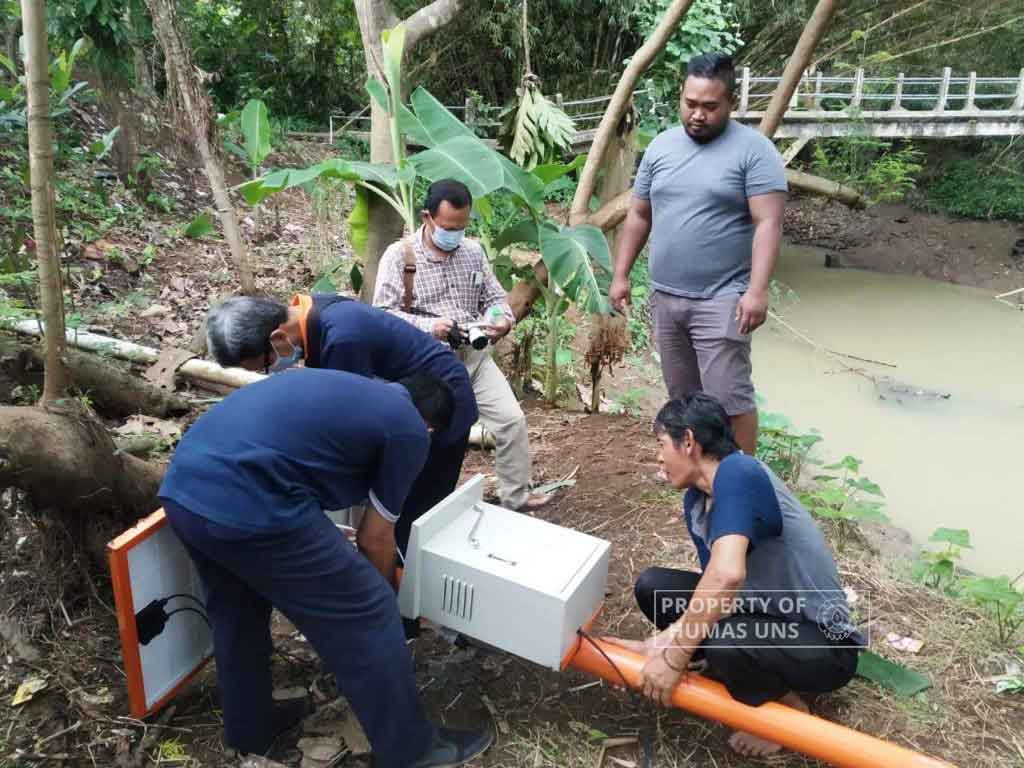
“Afterward, EWS stanchion pole orders and installation was done on May 27, 2021. The final installation was completed on June 19, 2021, including the installation of box panel and solar panel system,” Sorja Koesuma, S.Si., M.Si., explains on Saturday (26/6/2021).
Sorja added that one EWS was intalled at Sungai Dulang in Krandengan Village. The site is chosen for its recurring floods cases.
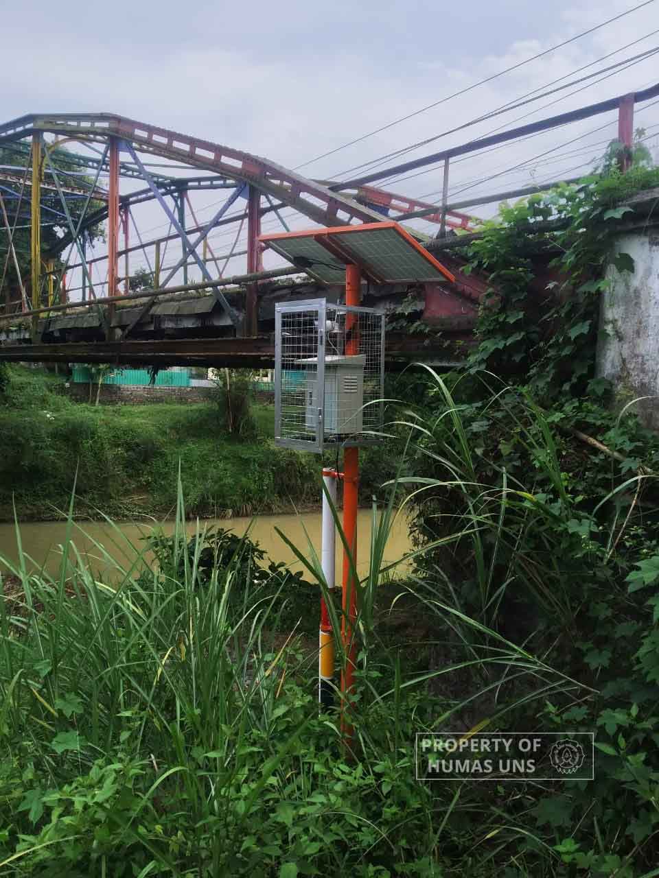
Another EWS equipment was installed in the Sungai Jali bridge located in Bayan Village, which is located approximately 6 km from Krandengan Village. He reveals that the second location is chosen as a floods preventive measure for the residents in Krandengan and its surrounding villages along the Sungai Jali riverbanks.
How Flood EWS Works
Each installed EWS is equipped with four signs level, blue color shows normal level, green shows standby state, yellow shows alert state, and red shows dangerous level.
Later on, at each level, there will be a sensor to detect the rise of the river level. When the river level rises, the information will be sent in the form of visual information through CCTV.
“And, the distance for each water level elevation can be checked through Android application that was developed specifically through the internet connection,” Sorja Koesuma, S.Si., M.Si., explains.
However, he reveals that the EWS installed in Sungai Dulang does not use a river-level sensor. This is decided because of the difference between Sungai Dulang riverbed contour and the on in Sungai Jali.
“So, we use the ultrasonic sensor. The river level data is submitted in a real-time manner and supported with CCTV information to ensure the rising water level,” he added.
Sorja Koesuma, S.Si., M.Si., adds that in the event of a water level rising warning goes off, the information can be submitted through notification generated by the application. However, the gadget used to receive the EWS information must be equipped with a specific application.
With the installation of EWS in Sungai Dulang and Sungai Jali, he hopes that the village residents should not depend on the tools. He wishes the residents remain active in conducting floods mitigation efforts in their respective villages.
“We cannot depend on the EWS tool as floods awareness and mitigation actions in Krandengan Village and its surrounding villages,” Sorja Koesuma, S.Si., M.Si., concluded. Humas UNS
Reporter: Yefta Christopherus AS
Editor: Dwi Hastuti